
The threat of severe thunderstorms is increasing across southwestern Texas overnight. The peak of this severe weather threat is expected late tonight into the pre-dawn hours of Tuesday. A new tornado watch has been issued for the Permian Basin, Pecos Valley, southern Concho Valley, and northern Edwards Plateau until 4 AM Tuesday.
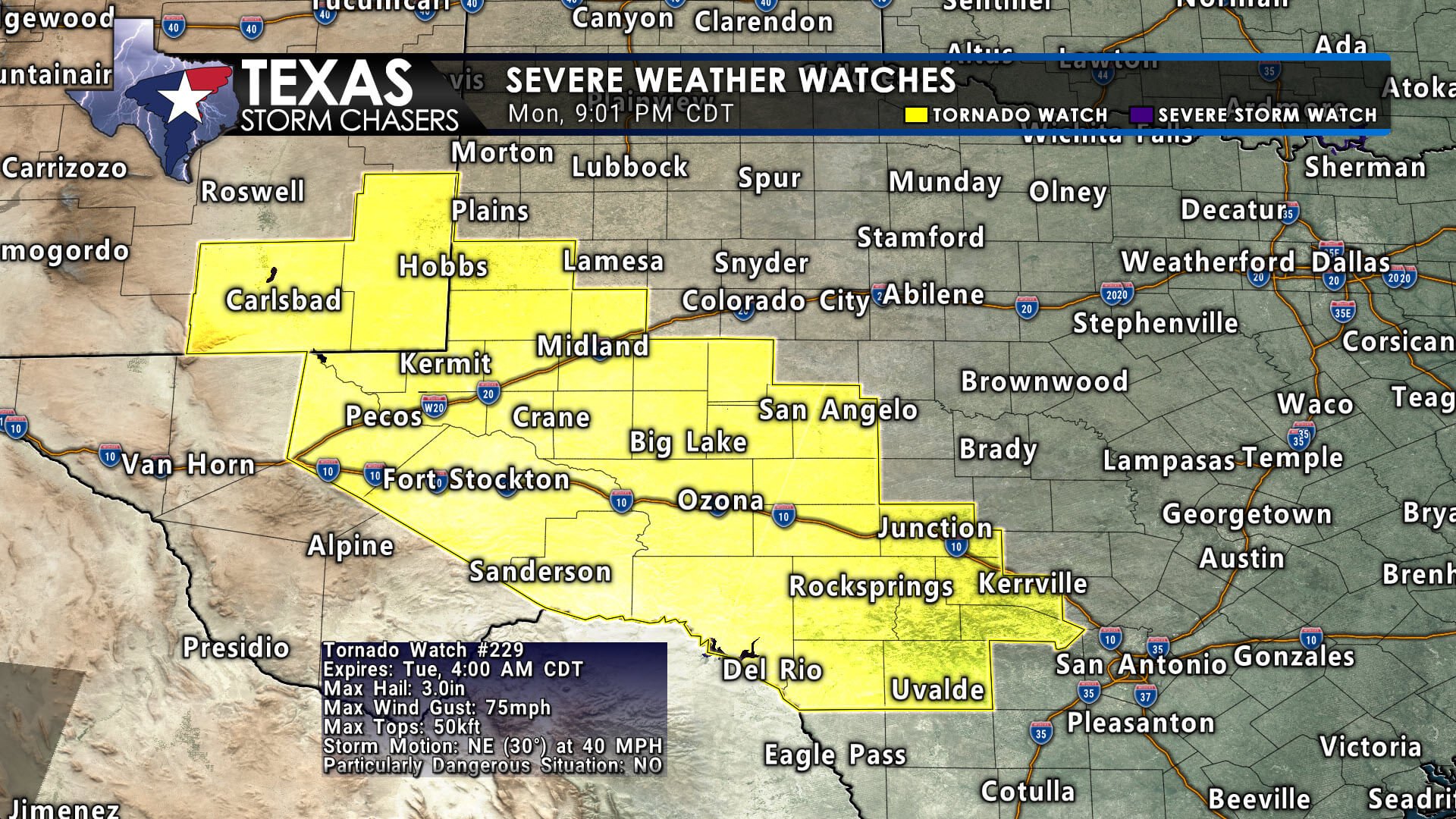

The most intense storms overnight could produce hail up to the size of baseballs, localized damaging wind gusts exceeding 70 MPH, and the possibility of a few tornadoes. The overall combination of instability and wind shear will be dangerously high in these regions, even during the night.
A slight advantage is that this severe weather is occurring overnight, which may allow for some low-level stabilization, potentially keeping the tornado threat more isolated. However, if that stabilization does not occur, we might still face a serious tornado threat with the most intense storms.

Click the ?/image for a full simulated weather radar animation.
Storms are expected to increase in frequency near and after midnight near the Rio Grande and northern Mexico. These storms will move east-northeast at 30 to 40 MPH mph into the affected areas. After 3 AM Tuesday, storms will likely make their way into the Hill Country, and eventually Central Texas and South-Central Texas before sunrise. The most intense storms are expected to continue producing severe weather—very large hail, damaging winds, and a possible tornado risk—throughout the night.
We will closely monitor the situation and provide frequent updates on our social media channels. If tornado warnings are issued in Texas near populated areas, we will also provide live severe weather coverage on our blog and app.