
12/26 10:40 Am – Numerous showers and thunderstorms are underway across Texoma, North Texas, the Brazos Valley, and Southeast Texas. We’re seeing an uptick in storm intensity across southern North Texas, where a storm with hail is moving northeast toward Corsicana. As we continue into the early afternoon, we anticipate an uptick in the tornado threat across portions of Southeast Texas, including the Houston metro, where the tornado risk has been upgraded.
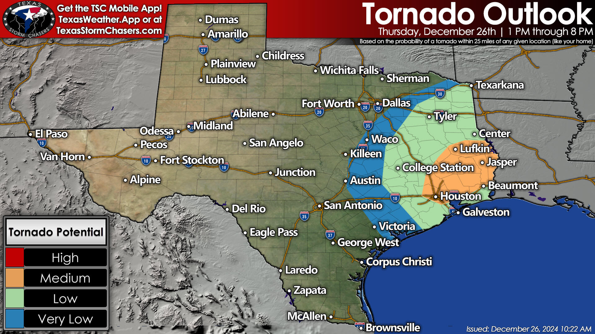

The threat of severe storms, including tornadoes, is expected to spread into Far East Texas and the Golden Triangle by late afternoon. The tornado risk in North Texas has been reduced, but large hail, strong winds, and heavy rain will continue to be a concern. Likewise, the tornado threat in Northeast Texas will remain on the low side today (not zero, but lower than in Southeast Texas) as the low levels remain a bit cool. Thunderstorms will exit Texas to the east by 8-9 PM.
Advertisements
We’ll have live severe weather coverage beginning at 12:30 PM, or sooner if necessary. That coverage will be embedded here on our website and mobile app.
A tornado watch will likely be issued in the next couple of hours for Southeast Texas, per the Storm Prediction Center.