
Active weather will continue across Texas for the final days of May and through the first week of June. This doesn’t mean that it will storm every single day in every part of Texas, but we are anticipating thunderstorm chances across the state every day for the next seven days.
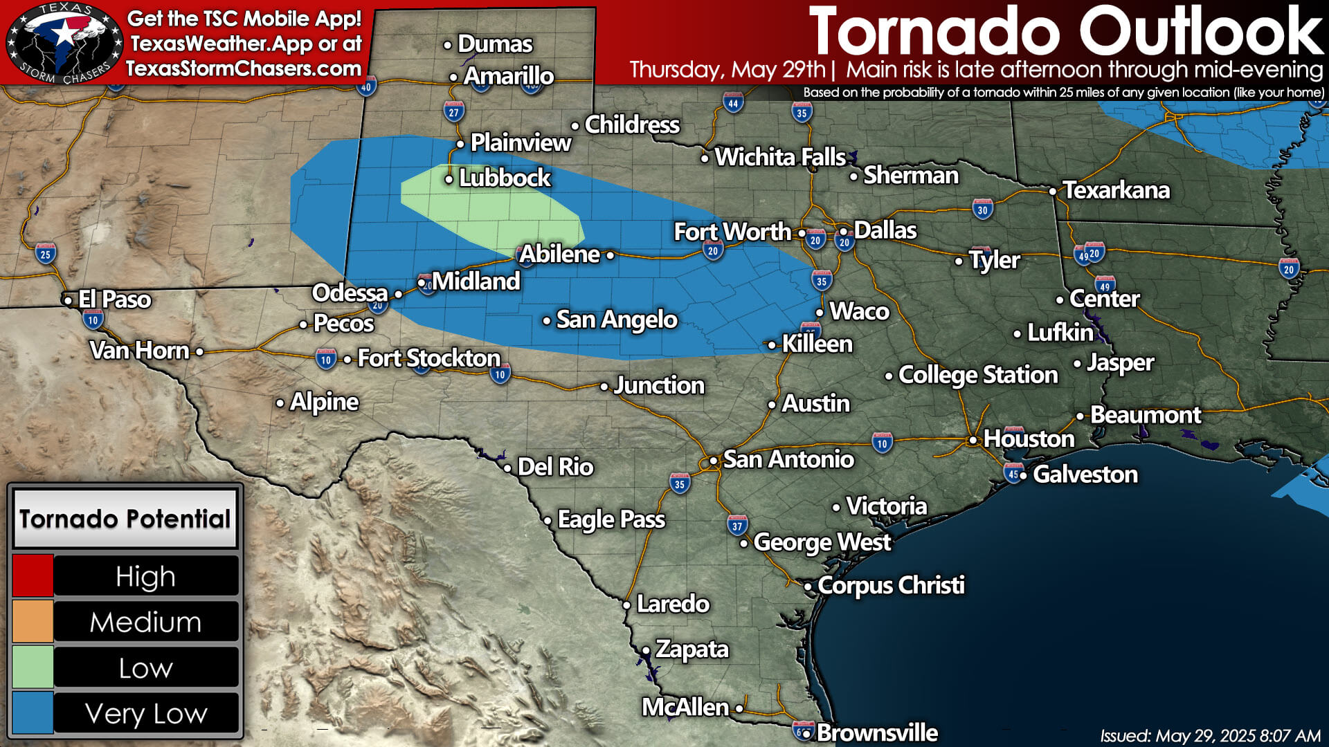
Today’s highest risk of severe thunderstorms will be in the Permian Basin, West Texas, Big Country, Concho Valley, Hill Country, and into Central Texas. We expect isolated supercell storms to develop by mid-afternoon in the Trans-Pecos area and extend into eastern New Mexico.
These storms will move east/southeast, posing a risk of extremely large hail, damaging wind gusts, and possibly a few tornadoes. This evening, those storms are expected to grow into a larger line or cluster that will move southeast through the regions mentioned.
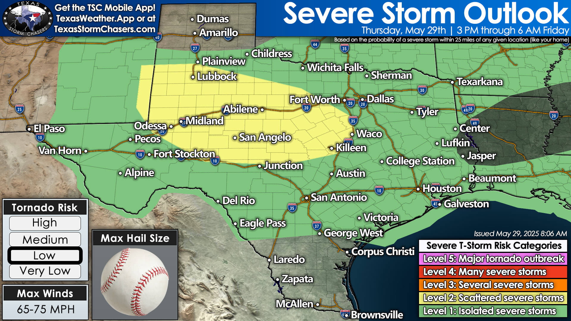


We will be monitoring strong to severe storms well into the pre-dawn hours of Friday as they continue southeast. The most intense storms tonight into Friday morning could produce hail the size of pocket change, damaging straight-line wind gusts, flash flooding, and an alarming amount of cloud-to-ground lightning strikes.
We will see pop-up storm chances continue on Friday and Saturday; however, we hope that severe weather will be less active during this time. This pattern may change by Sunday and especially on Monday, as another series of upper-level storm systems moves into western Texas, resuming our daily thunderstorm occurrences with an increase in severe thunderstorm chances.


It looks like we will remain active into the first week of June in Texas. One positive aspect of our continuing rain chances will be widespread cloud cover, which will help keep afternoon temperatures a bit cooler than average as we approach early summer.
Helpful Links
Our FREE WEATHER APP: https://texasweather.app/
Interactive Weather Radar: https://texasstormchasers.com/radar
Our Live Video Stream: https://texasstormchasers.com/live