; Cool Front Tomorrow!?")
Dense fog across the southeastern third of Texas this morning will give way to record-high temperatures this afternoon. Wildfire danger will be high to very high across the state’s northern half. Another round of fog is likely again Friday morning, burning off by lunchtime.
A cool front will bring north winds and cooler temperatures to the northwestern third of Texas tomorrow afternoon and the northwest half of Texas on Saturday. Folks in the southeastern half of Texas will not get any heat relief this weekend. All of Texas will be back into the 80s and 90s for afternoon high temperatures by Sunday, continuing through at least Tuesday.
Advertisements
Rain Chances Finally On The Horizon?
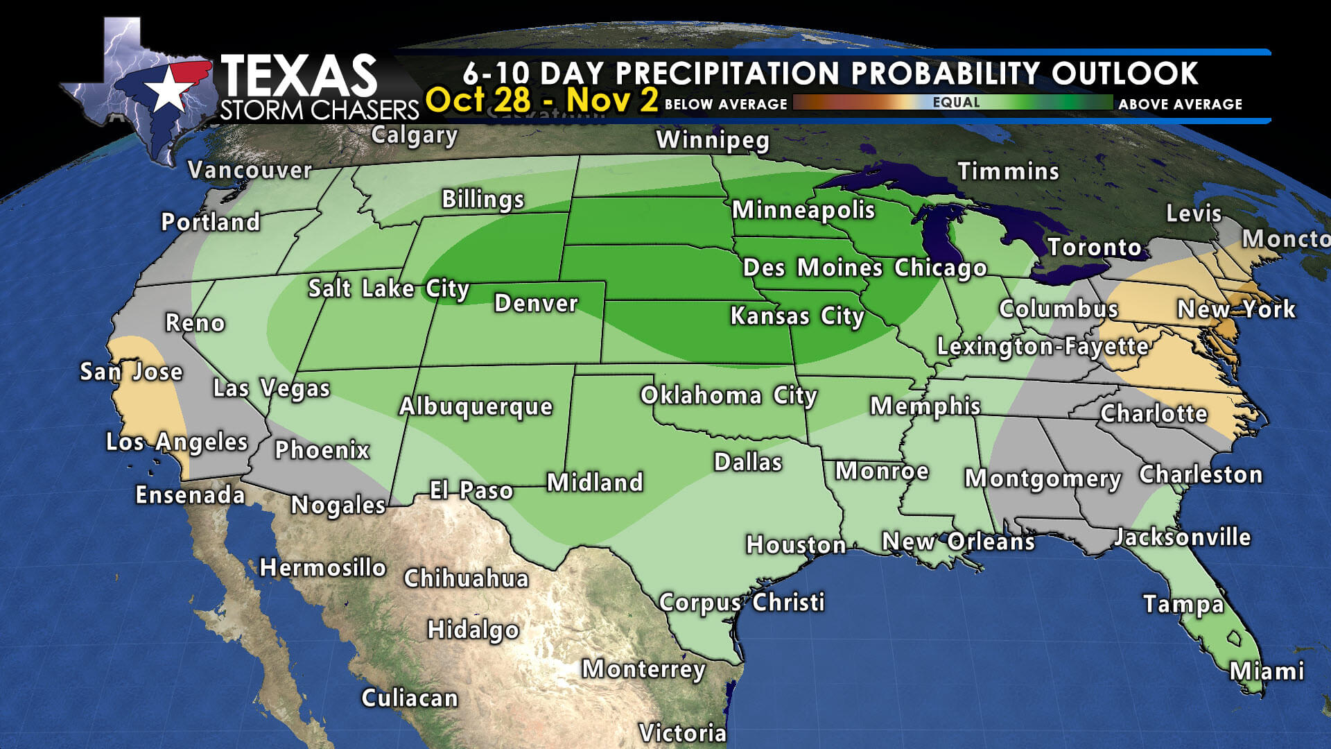

Indications are that a weather pattern shift will occur around Wednesday or Thursday next week, bringing an opportunity for precipitation and, eventually, some cooler temperatures. Until then, we anticipate little to no rain, a continuation of above-average temperatures, and high wildfire danger across Texas.
Check out our current LIVE STREAM: https://texasweather.video/
Our FREE WEATHER APP: https://texasweather.app/
Our WEBSITE/RADAR: https://www.texasstormchasers.com
Our SOCIAL PLATFORMS: https://linktr.ee/texasstormchasers