
Texas weather conditions are taking a turn as storm systems are set to return, following a brief respite. The threat of scattered severe storms has notably increased for later this afternoon and evening in regions including the Permian Basin, Northwest Texas, North Texas, Big Country, and Texoma.
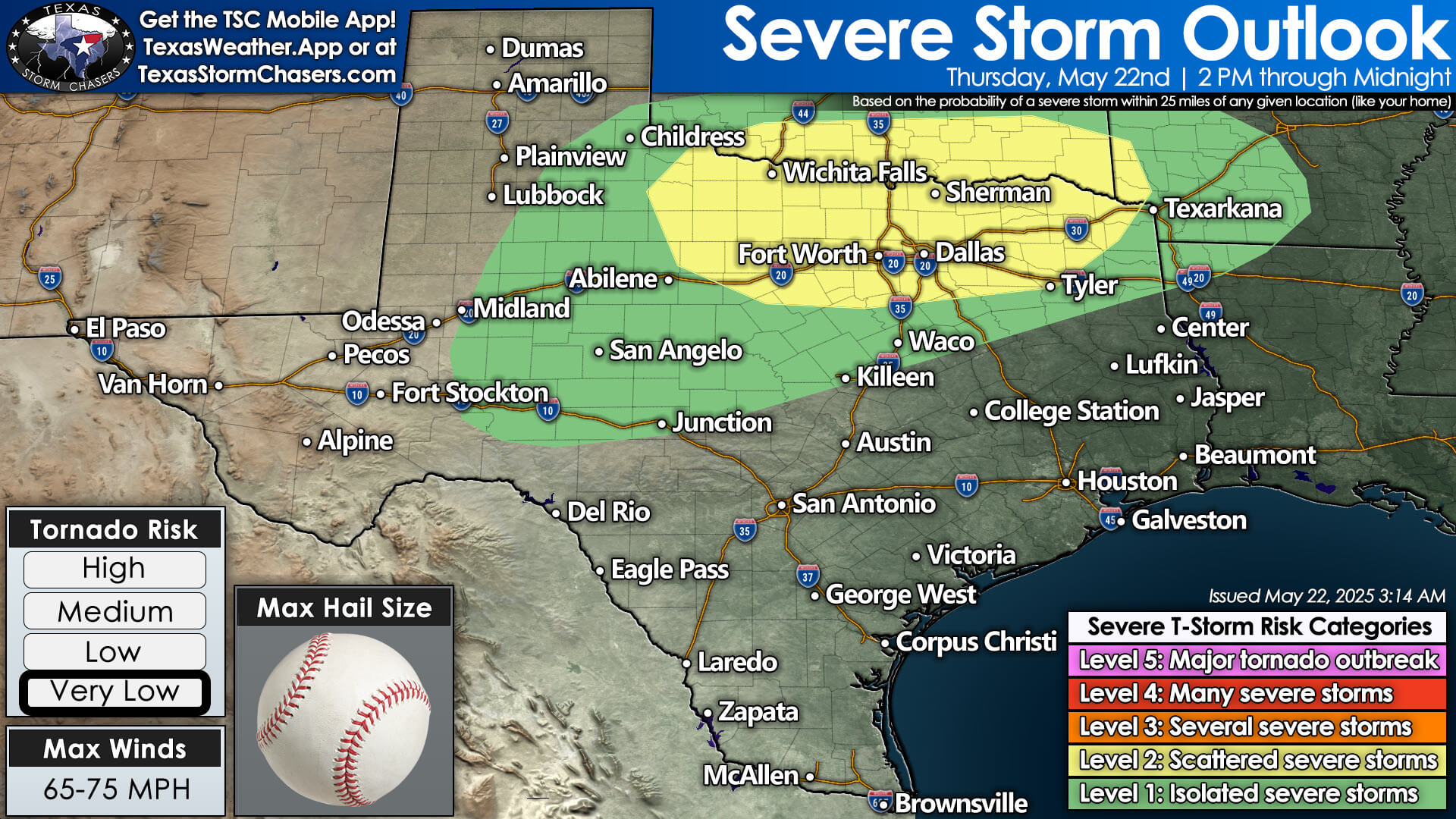


Storms are expected to develop as early as the afternoon in Oklahoma and Northwest Texas. These storms will likely merge into clusters and begin moving south and southeast into the affected regions late this afternoon and tonight. The main hazards include damaging wind gusts, large hail, heavy rain, and dangerous lightning, with a brief tornado possible.
As the evening progresses, storms may reach south of Interstate 20, extending towards the Hill Country and Central Texas overnight before gradually dissipating by tomorrow morning. Additional storm chances are anticipated on Friday and Saturday across the Permian Basin, West Texas, Texas Panhandle, and Northwest Texas, with similar threats of large hail and damaging winds.
Cold Front Brings Heat & Humidity Relief
A cold front is forecasted to push south into Texas on Sunday and Monday, bringing scattered to numerous thunderstorms, along with the potential for heavy rain and some severe weather. While the tornado risk remains relatively low for the upcoming days, monitoring for low-end tornado potential will continue.
By Monday and Tuesday, Texas may experience its final spring cold front, resulting in below-average high temperatures for the northern two-thirds of the state. Enjoy the cooler weather while it lasts, as summer is just around the corner.
Helpful Links
Interactive Weather Radar: https://texasstormchasers.com/radar
WATCH LIVE WEATHER: https://texasstormchasers.com/live
Our FREE WEATHER APP: https://texasweather.app/
Our SOCIAL PLATFORMS: https://linktr.ee/texasstormchasers