Note:
The expiration time in the watch graphic is amended if the watch is
replaced, cancelled or extended.
Note: Click for Watch Status Reports.
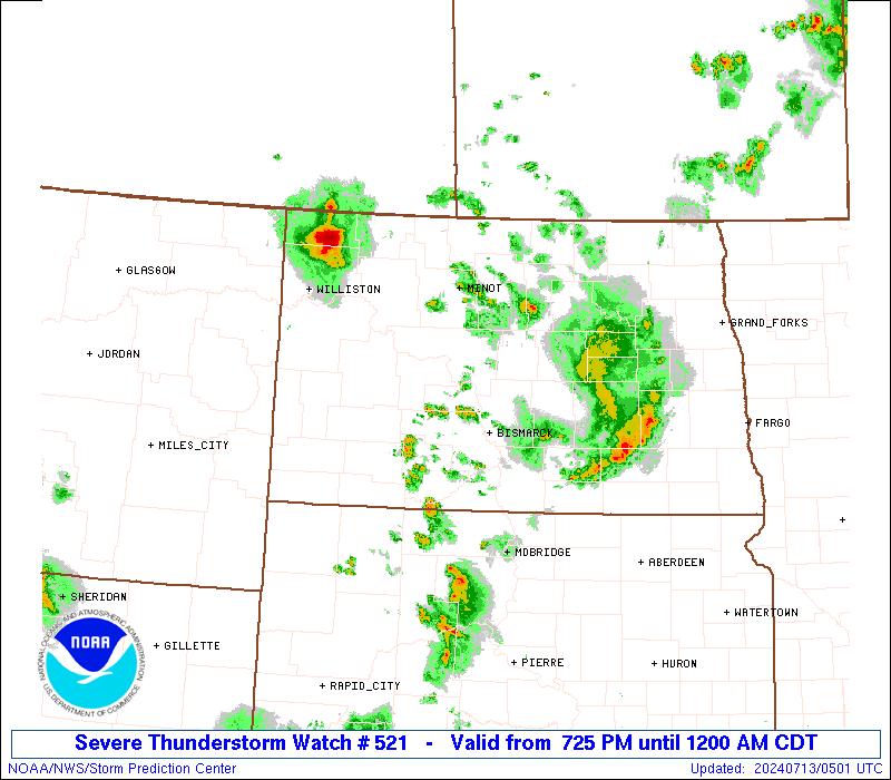
SEL1 URGENT - IMMEDIATE BROADCAST REQUESTED Severe Thunderstorm Watch Number 521 NWS Storm Prediction Center Norman OK 725 PM CDT Fri Jul 12 2024 The NWS Storm Prediction Center has issued a * Severe Thunderstorm Watch for portions of Western and Central North Dakota * Effective this Friday night from 725 PM until Midnight CDT. * Primary threats include... Scattered large hail and isolated very large hail events to 2 inches in diameter possible Isolated damaging wind gusts to 70 mph possible SUMMARY...Thunderstorms will continue to pose a threat for large hail generally 1-1.75 inches in diameter, and severe/damaging winds around 60-70 mph as they move east-southeastward this evening. The severe thunderstorm watch area is approximately along and 55 statute miles east and west of a line from 25 miles northeast of Minot ND to 60 miles south southwest of Bismarck ND. For a complete depiction of the watch see the associated watch outline update (WOUS64 KWNS WOU1). PRECAUTIONARY/PREPAREDNESS ACTIONS... REMEMBER...A Severe Thunderstorm Watch means conditions are favorable for severe thunderstorms in and close to the watch area. Persons in these areas should be on the lookout for threatening weather conditions and listen for later statements and possible warnings. Severe thunderstorms can and occasionally do produce tornadoes. && AVIATION...A few severe thunderstorms with hail surface and aloft to 2 inches. Extreme turbulence and surface wind gusts to 60 knots. A few cumulonimbi with maximum tops to 500. Mean storm motion vector 29025. ...Gleason