Note:
The expiration time in the watch graphic is amended if the watch is
replaced, cancelled or extended.
Note: Click for Watch Status Reports.
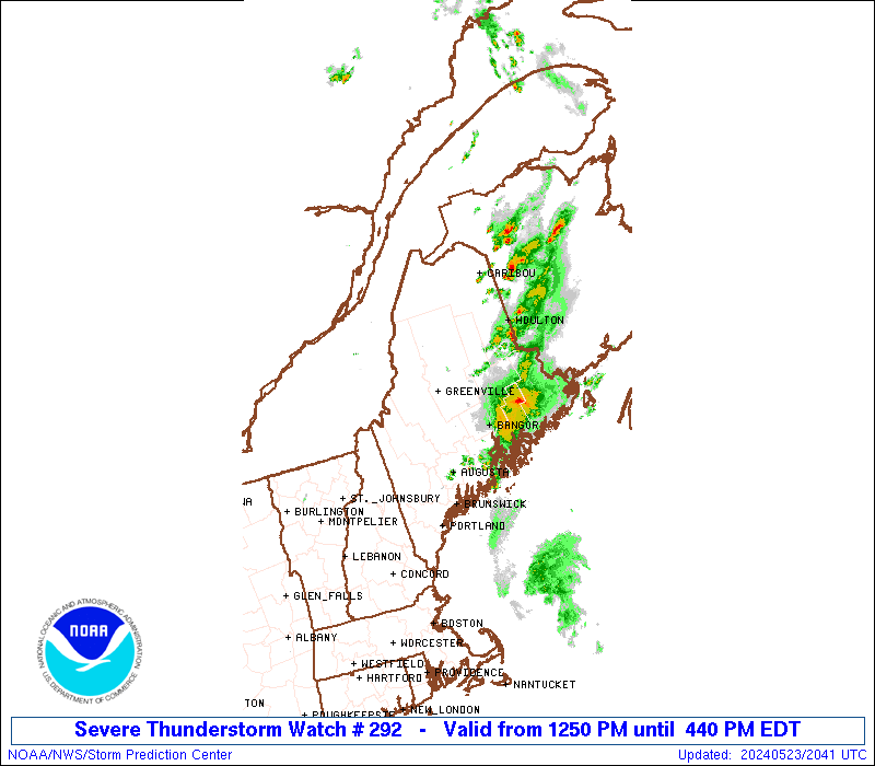
SEL2 URGENT - IMMEDIATE BROADCAST REQUESTED Severe Thunderstorm Watch Number 292 NWS Storm Prediction Center Norman OK 1250 PM EDT Thu May 23 2024 The NWS Storm Prediction Center has issued a * Severe Thunderstorm Watch for portions of Maine * Effective this Thursday afternoon and evening from 1250 PM until 700 PM EDT. * Primary threats include... Scattered damaging wind gusts to 65 mph possible Scattered large hail events to 1.5 inches in diameter possible SUMMARY...Thunderstorms are intensifying across western Maine, and should spread across the region through the afternoon. Locally damaging wind gusts and hail are possible in the stronger storms. The severe thunderstorm watch area is approximately along and 60 statute miles east and west of a line from 40 miles west northwest of Caribou ME to 25 miles east of Augusta ME. For a complete depiction of the watch see the associated watch outline update (WOUS64 KWNS WOU2). PRECAUTIONARY/PREPAREDNESS ACTIONS... REMEMBER...A Severe Thunderstorm Watch means conditions are favorable for severe thunderstorms in and close to the watch area. Persons in these areas should be on the lookout for threatening weather conditions and listen for later statements and possible warnings. Severe thunderstorms can and occasionally do produce tornadoes. && AVIATION...A few severe thunderstorms with hail surface and aloft to 1.5 inches. Extreme turbulence and surface wind gusts to 55 knots. A few cumulonimbi with maximum tops to 450. Mean storm motion vector 27030. ...Hart