
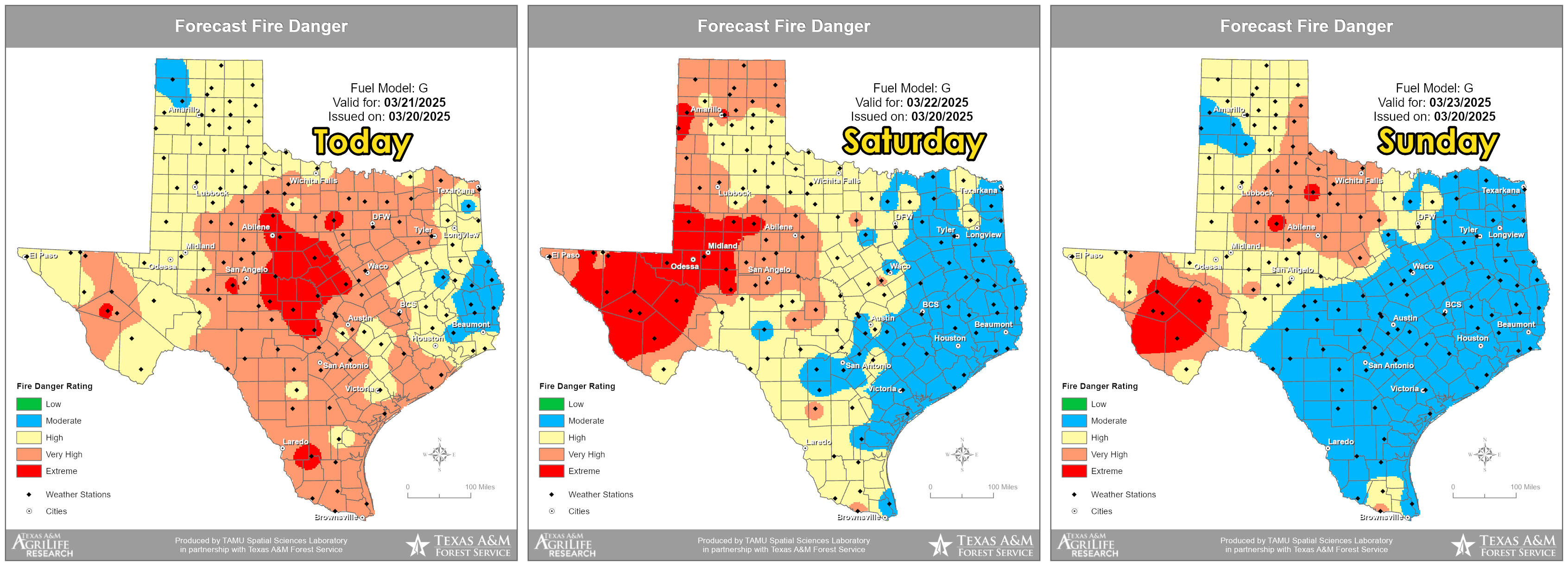
The light is finally shining at the end of the tunnel! After a rather dry March, we’re starting to see signs that a much-needed change in weather is on its way to Texas—especially as we head into next week. In the meantime, we’ll need to stay cautious as very high wildfire danger continues to affect many areas across the state.
Today and Saturday are expected to be dry, with high wildfire danger across all of Texas today. We’ll see that risk shift more towards the western half of the state on Saturday and Sunday. A weak cool front is on the way, bringing a chance for a few storms to parts of East Texas on Sunday. While overall storm chances are decreasing, there’s still the possibility that some storms might produce hail and strong wind gusts. Temperatures will dip just a bit in the northern half of Texas on Sunday, but not by much. The cool front will gently fade as it stalls in the Hill Country on Monday.
Advertisements
Storms return next week!
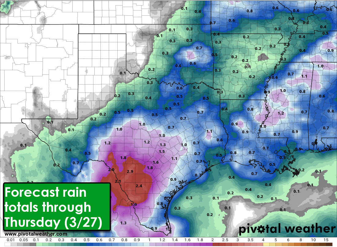
Looking ahead to next week, we’re excited to see increasing chances of scattered showers and storms across the southeastern half, possibly even up to two-thirds of Texas! Each day will bring its own specific storm chances based on where boundaries or stalled fronts settle in; but it’s encouraging to think we’ll finally have the best rain chances we’ve seen in weeks. Some of these storms may be on the stronger side, but overall, we’re looking forward to rain totals between half an inch to two inches!
Helpful Links
Check out our current LIVE STREAM: https://texasweather.video/
Our FREE WEATHER APP: https://texasweather.app/
GET ALERTED when in danger of severe storms and tornadoes! https://weathercallservices.com/tx-storm-chasers-nexgen
Our SOCIAL PLATFORMS: https://linktr.ee/texasstormchasers