
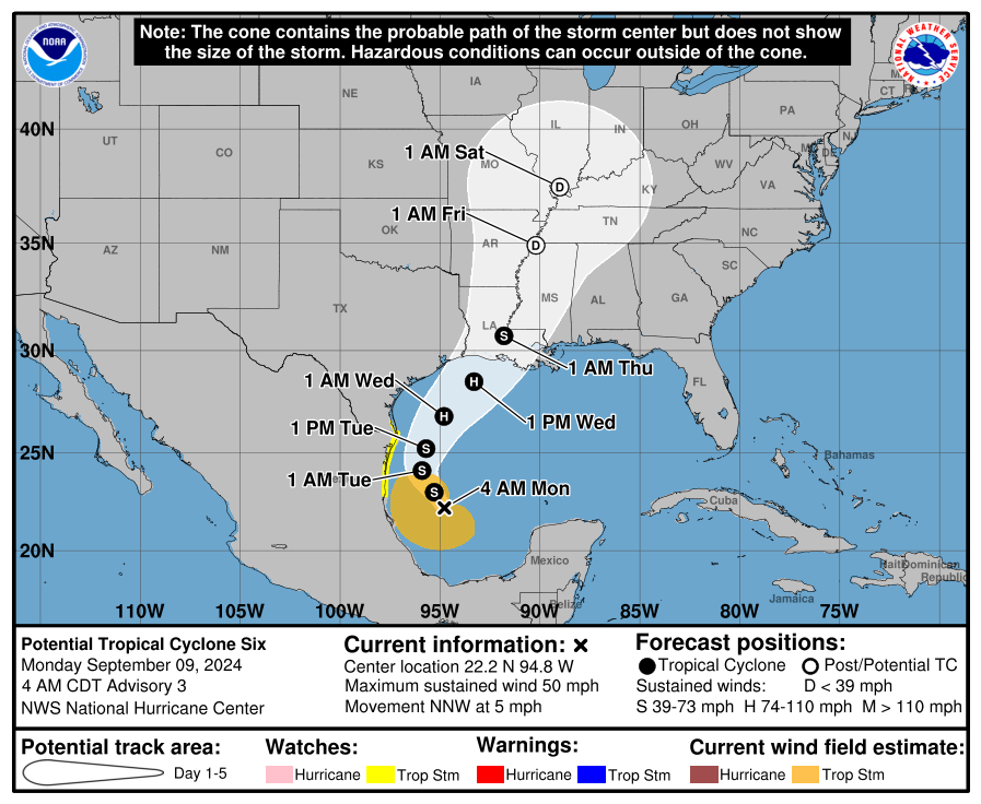
What will soon be named Francine is located 295 miles southeast of the mouth of the Rio Grande. The system is still in its formative stages and lacks a well-defined inner core. We expect that’ll change later today, and we should see the official tropical storm designation along with the name Francine.

Advertisements
Regardless of what the blob is called, showers are expected today into Tuesday across the Rio Grande Valley and the Lower Texas Gulf Coast. Some heavier rains and gusty winds are possible at times. The latest track forecast from the National Hurricane Center brings a northwest-moving Francine close enough to Brownsville and the Lower Texas Gulf Coast on Tuesday for a chance of rain, tropical storm force wind gusts over 45 MPH, and minor coastal flooding along most of the Texas Gulf Coast.
The system will turn to the north/northeast tomorrow and Wednesday. Francine should become a hurricane tomorrow night or Wednesday morning, with landfall now projected on the western or central Louisiana Gulf Coast Wednesday afternoon. Compared to last night, the track guidance has shifted east. While good news for Texas, this would bring hurricane-force winds and a dangerous storm surge to our neighbors in Louisiana.
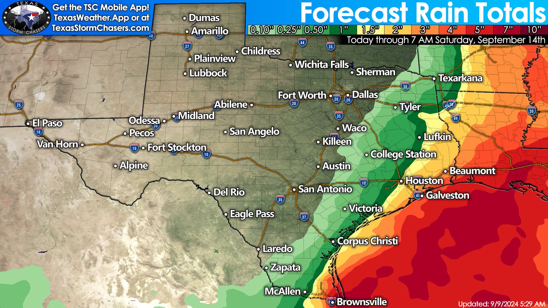

Some impacts, such as the chance of rain, gusty winds, and some risk of storm surge, will likely still exist along portions of the Upper Texas Gulf Coast and the Golden Triangle, but those impacts would be more of a glancing blow versus the total onslaught of the hurricane. As Francine moves into Louisiana, we’ll see an off-shore wind on the western side of the hurricane in Texas, pushing water away from the Upper Texas Gulf Coast. We’ll need to remain vigilant since a westward shift in the forecast track would bring higher impacts back into portions of the Golden Triangle and Southeast Texas Tuesday night and Wednesday.
Rest of Texas’ Weather This Week
Otherwise, the weather across Texas this week will be calm and mostly dry. Temperatures will be slowly climbing as we say goodbye to our first taste of fall. By mid-week, afternoon high temperatures will mostly be in the upper 80s to the upper 90s across Texas, with moderating overnight temperatures as well.
Helpful Links
Advertisements
Check out our current LIVE STREAM: https://texasweather.video/
Our FREE WEATHER APP: https://texasweather.app/
Our WEBSITE/RADAR: https://www.texasstormchasers.com/radar
Our SOCIAL PLATFORMS: https://linktr.ee/texasstormchasers