
Thunderstorm chances and a cold front are in the forecast for parts of Texas this weekend! Today? We’re in for record-high temperatures and some triple-digit heat. If you didn’t have a calendar handy, you wouldn’t be faulted for thinking we’re still in July or August. Alas, we’ve entered late September and have summer temperatures again today.
If you’re using the free Texas Storm Chasers mobile app, you’ll already know your forecast high-temperature today! It’s going to be hot with 90s to lower 100s. This afternoon, isolated thunderstorms will be possible across South-Central Texas, the Coastal Bend, and Deep South Texas. Scattered showers and storms will also be possible in the Texas Panhandle late this afternoon into Saturday morning.
Advertisements
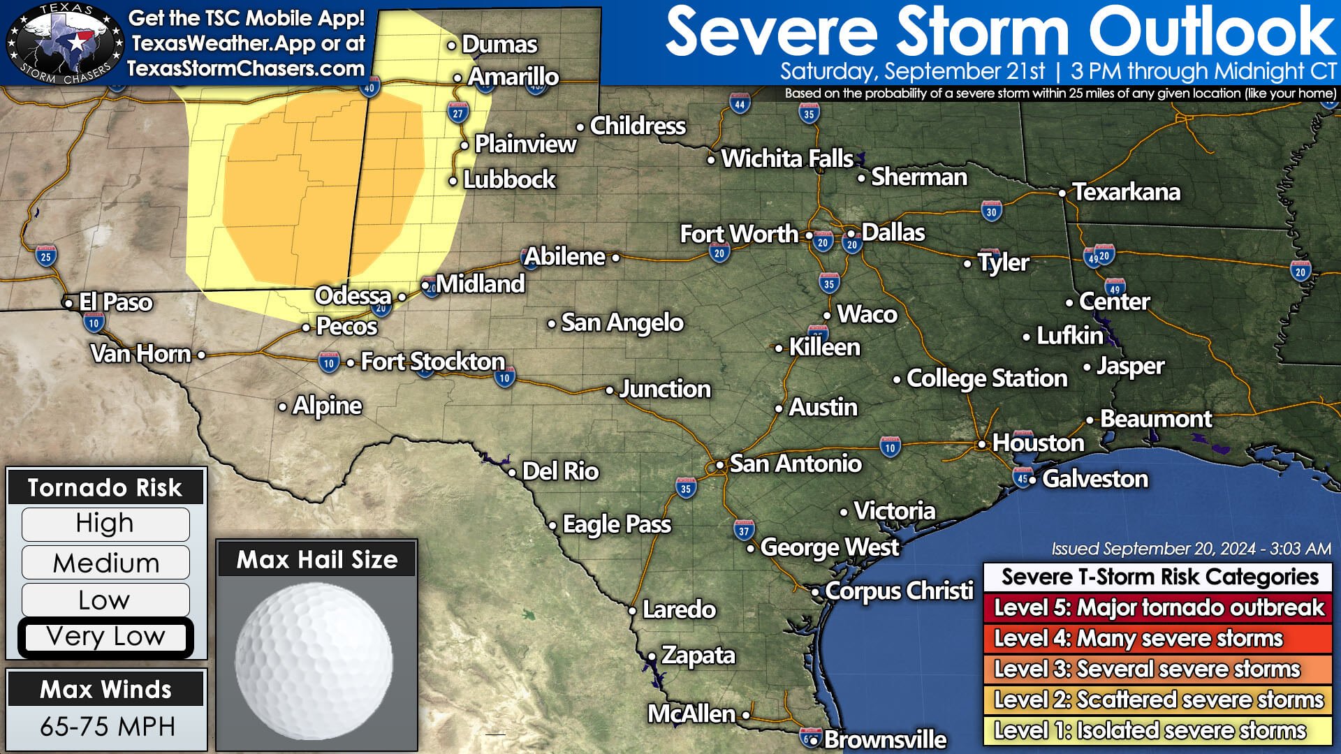

As we enter Saturday afternoon, scattered strong to severe storms will develop in eastern New Mexico. Those storms will move into the Texas Panhandle and West Texas after 3 PM Saturday and progress east toward Interstate 27 by mid-evening. Damaging winds, large hail, and locally heavy rain are expected with the most intense storms. A brief tornado can’t be ruled out. The Texas Tech game in Lubbock should be good to go, with storms not expected until later in the evening.
A cold front will move southeast Saturday night into Sunday, with thunderstorm chances Sunday afternoon into Monday morning from Northwest Texas, the Big Country, and Permian Basin moving into Texoma and North Texas. Some storms may be strong with localized damaging winds and hail. Temperatures will be much more pleasant behind the front across the northwestern half of Texas on Sunday and Monday. The southeastern half of Texas will remain seasonably hot.
Another Gulf of Mexico Tropical System Next Week?
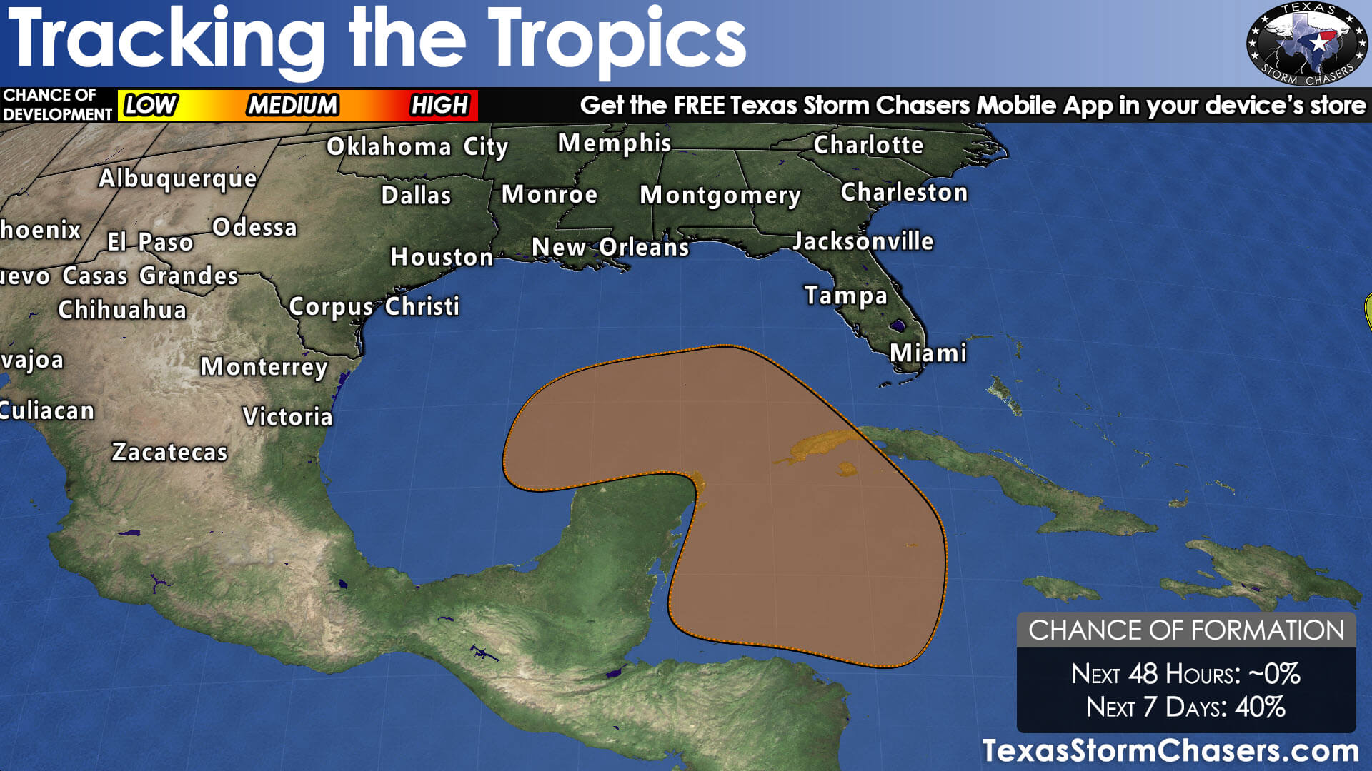
Questions emerge by Tuesday and Wednesday as another possible weather-maker arrives. Longer-range weather model data differs in the intensity and placement of certain features, but active weather may continue with additional rain chances for the northern half of Texas. In the tropics, a possible tropical cyclone may organize in the north Caribbean early next week and move into the Gulf of Mexico by mid-week. Until the system develops a defined low-level center, longer-range forecasts will be difficult (so folks sharing spooky-looking model images at this range should probably be on your no-no list for reliable information).
Advertisements
Historically, systems in late September originating in the northern Caribbean tend to favor tracks toward Louisiana to Florida. Still, the entire Gulf Coast must monitor the forecasts next week. If we do end up with another cold front/upper-level system in Texas by mid-week, that may also tend to favor any tropical mischief being pushed a bit further east – but that is all in the longer-range weather model voodoo land at this time.