Note:
The expiration time in the watch graphic is amended if the watch is
replaced, cancelled or extended.
Note: Click for Watch Status Reports.
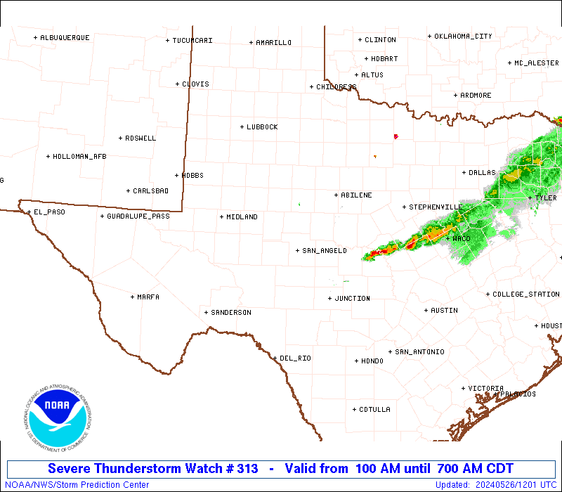
SEL3 URGENT - IMMEDIATE BROADCAST REQUESTED Severe Thunderstorm Watch Number 313 NWS Storm Prediction Center Norman OK 100 AM CDT Sun May 26 2024 The NWS Storm Prediction Center has issued a * Severe Thunderstorm Watch for portions of West-central Texas * Effective this Sunday morning from 100 AM until 700 AM CDT. * Primary threats include... Scattered large hail and isolated very large hail events to 3 inches in diameter possible Isolated damaging wind gusts to 60 mph possible SUMMARY...Thunderstorms have developed along a dryline over the eastern Permian Basin area, with additional towers evident to the south in satellite imagery. The environment supports significant (2+ inch) damaging hail with any storms that can persist, as convection shifts eastward toward the Concho Valley region. Though capping strengthens eastward from the dryline, isolated severe gusts also may occur. The severe thunderstorm watch area is approximately along and 60 statute miles east and west of a line from 40 miles southwest of San Angelo TX to 55 miles north northeast of San Angelo TX. For a complete depiction of the watch see the associated watch outline update (WOUS64 KWNS WOU3). PRECAUTIONARY/PREPAREDNESS ACTIONS... REMEMBER...A Severe Thunderstorm Watch means conditions are favorable for severe thunderstorms in and close to the watch area. Persons in these areas should be on the lookout for threatening weather conditions and listen for later statements and possible warnings. Severe thunderstorms can and occasionally do produce tornadoes. && OTHER WATCH INFORMATION...CONTINUE...WW 309...WW 310...WW 311...WW 312... AVIATION...A few severe thunderstorms with hail surface and aloft to 3 inches. Extreme turbulence and surface wind gusts to 50 knots. A few cumulonimbi with maximum tops to 600. Mean storm motion vector 27025. ...Edwards