
We’re in for the continuation of chilly weather as we head into tonight and Friday! The northern third of Texas will stay below freezing today, and almost all of Texas will experience freezing temps tonight, with the exception of the Rio Grande Plains and Rio Grande Valley. Make sure to take care with your cold weather precautions! Fortunately, all of Texas should warm up above freezing tomorrow, although some places might only stay warm for a little while before dipping in temperature again on Friday night. Some communities will have felt the freeze for three full days, so be aware that as the temperatures rise, there may be an uptick in pipe bursts. Keep an eye on those frozen pipes—they can burst, especially if they’re located in external walls as they start to thaw!
Now, let’s talk about rain! We’re expecting showers Friday afternoon through Saturday afternoon in the Rio Grande Valley, Rio Grande Plains, Coastal Bend, Coastal Plains, Southeast Texas, Brazos Valley, and the Golden Triangle. Thankfully, many of these areas will remain above freezing, so ice shouldn’t be an issue. That said, there might be a small chance of some isolated icing tonight in parts of South-Central Texas, but any impacts are expected to be quite minimal.
Advertisements
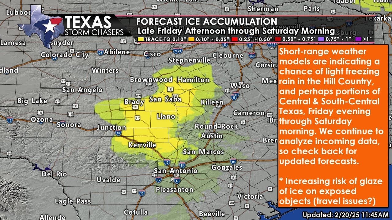

As we move into late Friday afternoon and Saturday morning, the forecast gets a bit tricky for South-Central Texas, Central Texas, and the Hill Country. Short-range weather models are showing a growing chance of some freezing drizzle and light freezing rain in those regions, which could affect areas from Austin to San Antonio and into the Hill Country. With temperatures hovering around 28 to 33 degrees, there’s a chance for light ice buildup, which may lead to slippery bridges, overpasses, and highway ramps. This risk could even extend to some surface roads, especially since many have been cold-soaked since Tuesday. We promise to keep you posted on the latest updates as we gather more information, but be prepared for possible travel impacts in South-Central Texas, Central Texas, and the Hill Country later on Friday and into Saturday morning.
Looking ahead to Saturday, we can expect more substantial showers and possibly a few storms in East Texas, Southeast Texas, and the Golden Triangle. Thankfully, no severe storms are on the horizon, but we could see heavier rain totals of up to one and a half inches, which may lead to some isolated flooding. The chance of rain will taper off from west to east by Saturday evening, leaving Texas nice and dry for much of the upcoming week. Plus, a warm-up is coming next week, with highs soaring into the 70s and 80s by Monday!