
This morning, Texas is starting off chilly. A slow warmup will commence as we head into the weekend, and thunderstorm chances are high in the Texas Panhandle, West Texas, and Borderland.
This morning, temperatures in the northern two-thirds of Texas dropped into the 30s and 40s. However, afternoon high temperatures will rise comfortably into the 70s to lower 80s. Rain showers will remain possible in the Rio Grande Valley and South Texas.
Advertisements
Late tonight, showers and a few storms will move east into the Borderland, Guadalupe Mountains, and Trans-Pecos. Activity will weaken as it moves into the Permian Basin tomorrow morning. Scattered thunderstorm chances will increase Friday night in western portions of the Texas Panhandle and West Texas. The highest chances will be near the New Mexico state line and west.
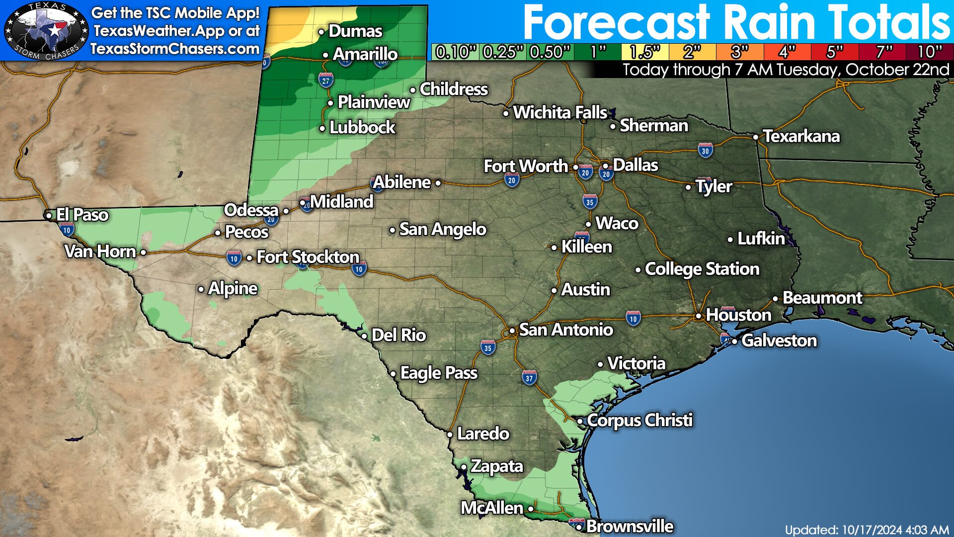

Multiple rounds of thunderstorms are likely in the Texas Panhandle and West Texas on Saturday, Sunday, and Monday morning. One to three inches of rain may fall across the northwestern and northern Panhandle, with up to one inch of rain possibly across the remainder of the Panhandle south into West Texas. A few storms may be strong to severe, with pocket-change-size hail, strong winds, and a non-zero risk of a brief tornado near the New Mexico/Texas line.
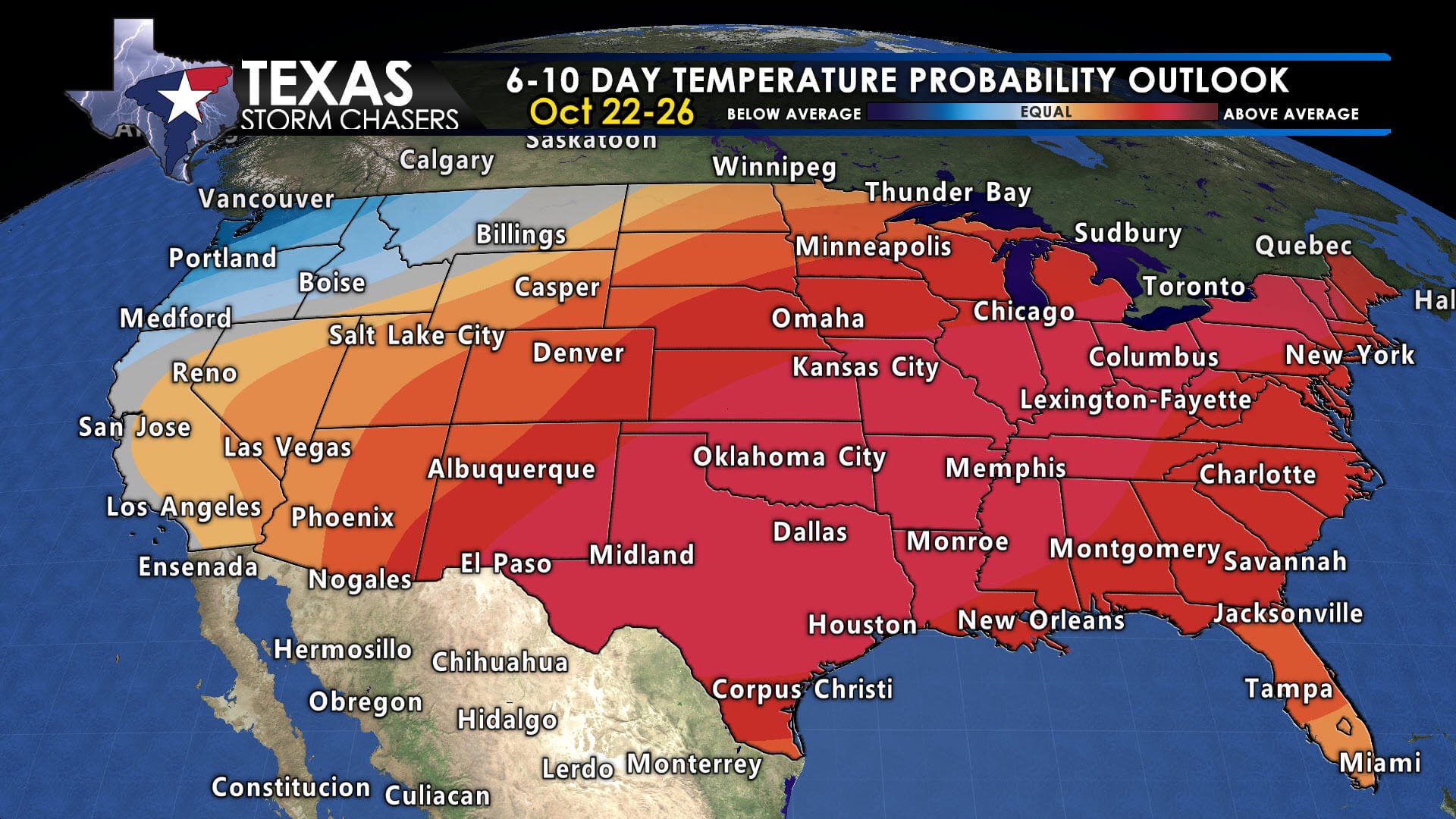
The rest of Texas looks dry outside of isolated showers in the Rio Grande Valley and South Texas early next week. Temperatures will warm, with highs back into the 80s by Sunday and Monday.
Helpful Links
Advertisements
Check out our current LIVE STREAM: https://texasweather.video/
Our FREE WEATHER APP: https://texasweather.app/
Our WEBSITE/RADAR: https://www.texasstormchasers.com
Our SOCIAL PLATFORMS: https://linktr.ee/texasstormchasers