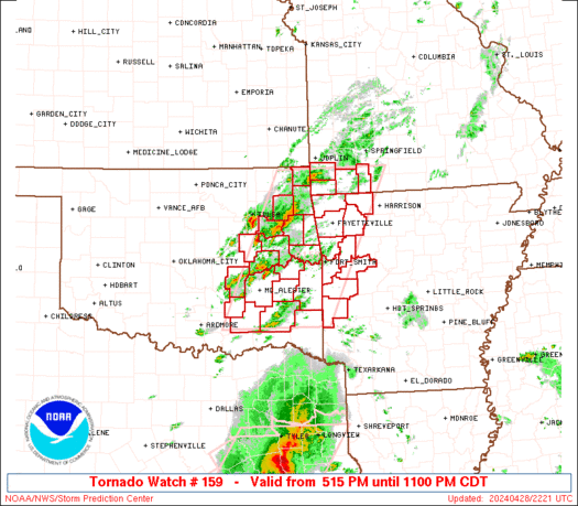
Storms will Move East across Texas Tonight into Wednesday Morning

Storms will Move East across Texas Tonight into Wednesday Morning

Scattered severe storms are underway in the eastern Texas Panhandle, West Texas, and south into the Permian Basin. Our typical ‘Fort Stockton’ supercell is currently located southeast of town on Highway 285. Large hail, strong winds, and perhaps a brief tornado remain possible with these storms. These storms are occurring in extremely remote areas, which […]

SPC Severe Thunderstorm Watch 160

WW 160 SEVERE TSTM KS OK TX 222230Z – 230600Z
WW 0160 Image

 URGENT - IMMEDIATE BROADCAST REQUESTED
Severe Thunderstorm Watch Number 160
NWS Storm Prediction Center Norman OK
530 PM CDT Tue Apr 22 2025 The NWS Storm Prediction Center has issued a * Severe Thunderstorm Watch for portions of South-Central Kansas Western Oklahoma Northwest Texas * Effective this Tuesday afternoon and Wednesday morning from 530 PM until 100 AM CDT. * Primary threats include... Scattered large hail and isolated very large hail events to 2.5 inches in diameter possible Scattered damaging wind gusts to 70 mph possible A tornado or two possible SUMMARY...Thunderstorm development is anticipated this evening from
south-central KS southward through western OK into northwest TX. The
environment across the region supports the potential for supercells,
with large to very large hail as the primary risk. A tornado or two
is also possible, along with some strong gusts as well. The severe thunderstorm watch area is approximately along and 50
statute miles east and west of a line from 45 miles northwest of
Hutchinson KS to 60 miles southwest of Wichita Falls TX. For a
complete depiction of the watch see the associated watch outline
update (WOUS64 KWNS WOU0). PRECAUTIONARY/PREPAREDNESS ACTIONS... REMEMBER...A Severe Thunderstorm Watch means conditions are
favorable for severe thunderstorms in and close to the watch area.
Persons in these areas should be on the lookout for threatening
weather conditions and listen for later statements and possible
warnings. Severe thunderstorms can and occasionally do produce
tornadoes. && OTHER WATCH INFORMATION...CONTINUE...WW 159... AVIATION...A few severe thunderstorms with hail surface and aloft to
2.5 inches. Extreme turbulence and surface wind gusts to 60 knots. A
few cumulonimbi with maximum tops to 500. Mean storm motion vector
24035. ...Mosier 

Read more

Severe Storm Watch Issued for West Texas; Storms Move East Tonight

Severe Storm Watch Issued for West Texas; Storms Move East Tonight

A severe thunderstorm watch has been issued until 11 PM for the eastern Texas Panhandle, West Texas, Permian Basin, western Concho Valley, and into the northern Edwards Plateau. Some of the cities included in this watch are Sanderson, Fort Stockton, Ozona, Sonora, Odessa, Midland, Big Spring, San Angelo, Sweetwater, Lamesa, Post, Lubbock, Spur, Plainview, Childress, […]

SPC Severe Thunderstorm Watch 159

WW 159 SEVERE TSTM TX 222015Z – 230400Z
WW 0159 Image

 URGENT - IMMEDIATE BROADCAST REQUESTED
Severe Thunderstorm Watch Number 159
NWS Storm Prediction Center Norman OK
315 PM CDT Tue Apr 22 2025 The NWS Storm Prediction Center has issued a * Severe Thunderstorm Watch for portions of West Texas * Effective this Tuesday afternoon and evening from 315 PM until 1100 PM CDT. * Primary threats include... Scattered damaging winds and isolated significant gusts to 75 mph likely Scattered large hail and isolated very large hail events to 2.5 inches in diameter likely A tornado or two possible SUMMARY...Thunderstorms will develop and increase in coverage
through the afternoon and evening across much of west Texas, in an
increasingly moist and unstable environment. The strongest cells
are expected to produce large hail and damaging wind gusts. The severe thunderstorm watch area is approximately along and 70
statute miles east and west of a line from 45 miles northeast of
Amarillo TX to 35 miles east of Dryden TX. For a complete depiction
of the watch see the associated watch outline update (WOUS64 KWNS
WOU9). PRECAUTIONARY/PREPAREDNESS ACTIONS... REMEMBER...A Severe Thunderstorm Watch means conditions are
favorable for severe thunderstorms in and close to the watch area.
Persons in these areas should be on the lookout for threatening
weather conditions and listen for later statements and possible
warnings. Severe thunderstorms can and occasionally do produce
tornadoes. && AVIATION...A few severe thunderstorms with hail surface and aloft to
2.5 inches. Extreme turbulence and surface wind gusts to 65 knots. A
few cumulonimbi with maximum tops to 500. Mean storm motion vector
27025. ...Hart 

Read more

Strong to Severe Storms Tracking Across Western Texas Tonight — Hail, Gusty Winds Possible

Strong to Severe Storms Tracking Across Western Texas Tonight — Hail, Gusty Winds Possible

Scattered thunderstorms are forecasted to develop across the Permian Basin and West Texas this afternoon, with activity expected to pick up after 3 PM. The initial storm formations are likely to occur west of Fort Stockton, which is situated about 70 miles south of Odessa. This area is prominently recognized as a hotspot for thunderstorm […]