Month: April 2025
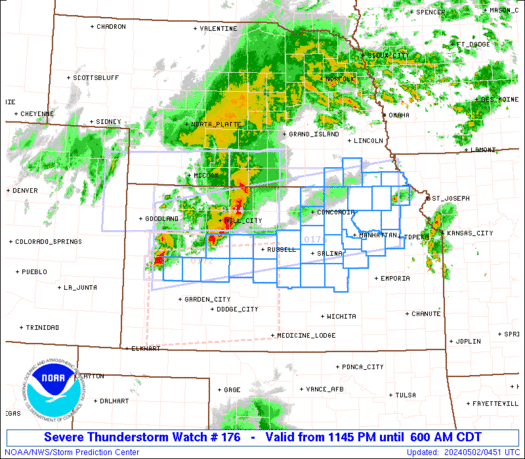
SPC Tornado Watch 176
WW 176 TORNADO AR OK TX 262145Z – 270300Z 
 URGENT - IMMEDIATE BROADCAST REQUESTED
Tornado Watch Number 176
NWS Storm Prediction Center Norman OK
445 PM CDT Sat Apr 26 2025 The NWS Storm Prediction Center has issued a * Tornado Watch for portions of Southwest Arkansas Southeast Oklahoma Far Northeast Texas * Effective this Saturday afternoon and evening from 445 PM until 1000 PM CDT. * Primary threats include... A couple tornadoes possible Isolated damaging wind gusts to 70 mph possible Isolated large hail events to 1.5 inches in diameter possible SUMMARY...Environment will remain sufficiently favorable for some
supercell storms through at least early evening across the region,
which includes some tornado potential. The tornado watch area is approximately along and 55 statute miles
north and south of a line from 40 miles south southwest of Mcalester
OK to 40 miles south of Hot Springs AR. For a complete depiction of
the watch see the associated watch outline update (WOUS64 KWNS
WOU6). PRECAUTIONARY/PREPAREDNESS ACTIONS... REMEMBER...A Tornado Watch means conditions are favorable for
tornadoes and severe thunderstorms in and close to the watch
area. Persons in these areas should be on the lookout for
threatening weather conditions and listen for later statements
and possible warnings. && OTHER WATCH INFORMATION...CONTINUE...WW 175... AVIATION...Tornadoes and a few severe thunderstorms with hail
surface and aloft to 1.5 inches. Extreme turbulence and surface wind
gusts to 60 knots. A few cumulonimbi with maximum tops to 450. Mean
storm motion vector 24025. ...Guyer
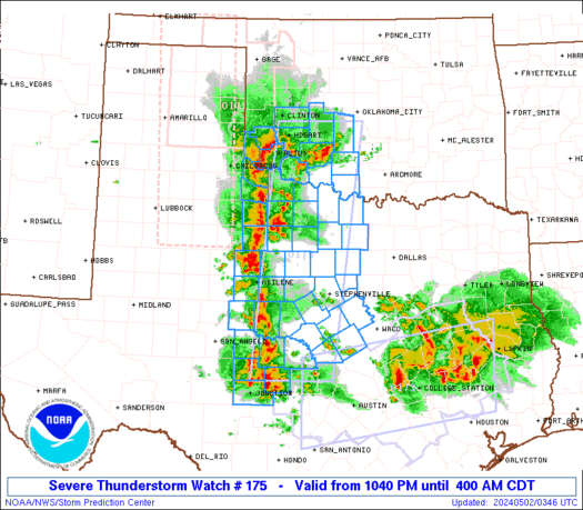
SPC Tornado Watch 175
WW 175 TORNADO NM TX 262050Z – 270300Z 
 URGENT - IMMEDIATE BROADCAST REQUESTED
Tornado Watch Number 175
NWS Storm Prediction Center Norman OK
250 PM MDT Sat Apr 26 2025 The NWS Storm Prediction Center has issued a * Tornado Watch for portions of Eastern New Mexico West Texas * Effective this Saturday afternoon and evening from 250 PM until 900 PM MDT. * Primary threats include... A couple tornadoes possible Scattered large hail and isolated very large hail events to 3 inches in diameter likely Isolated damaging wind gusts to 70 mph possible SUMMARY...Isolated to widely scattered severe thunderstorms are
forecast to develop this afternoon into the evening. Supercells
capable of large to very large hail and possibly a couple of
tornadoes will be the primary hazards. The tornado watch area is approximately along and 60 statute miles
east and west of a line from 50 miles northwest of Tucumcari NM to
45 miles south southwest of Hobbs NM. For a complete depiction of
the watch see the associated watch outline update (WOUS64 KWNS
WOU5). PRECAUTIONARY/PREPAREDNESS ACTIONS... REMEMBER...A Tornado Watch means conditions are favorable for
tornadoes and severe thunderstorms in and close to the watch
area. Persons in these areas should be on the lookout for
threatening weather conditions and listen for later statements
and possible warnings. && AVIATION...Tornadoes and a few severe thunderstorms with hail
surface and aloft to 3 inches. Extreme turbulence and surface wind
gusts to 60 knots. A few cumulonimbi with maximum tops to 450. Mean
storm motion vector 27020. ...Smith
Death Valley National Park reopens roads destroyed by historic floods
Death Valley National Park has reopened routes to cooler, high-elevation areas for park visitors ahead of scorching summer months.
See it: Torrential rains cause flash flooding in Oklahoma, Texas
Torrential rainfall swept through southwest Oklahoma early Saturday, triggering flash flooding. Numerous water rescues were reported in Lawton, Oklahoma and Norman.
Watch: Dust devil causes chaos at Montana track meet
A dust devil that spun up at a track meet in Montana had people running for cover on Thursday.
Watch: Bear slides down playset slide as child shrieks in happiness
A family in Connecticut got a surprise backyard visitor when a bear decided to play on their playset, going down the slide.
See it: Hubble Space Telescope celebrates 35 years of making ground-breaking discoveries
On April 25, 1990, the Hubble Space Telescope was deployed into Earthâs orbit, beginning a decades-long venture into capturing images of the universe.
Weekend Weather Update from FOX Weather: Potential tornado outbreak threat grows for final week of April
Top weather news for April 26, 2025: The danger of a widespread tornado outbreak is growing for Monday across the Upper Midwest and into the Southern Plains with threats of strong tornadoes, large hail and damaging wind gusts.


