SPC – No watches are valid as of Fri Apr 11 04:02:02 UTC 2025
No watches are valid as of Fri Apr 11 04:02:02 UTC 2025.
24/7 Tornado Newsfeed
No watches are valid as of Fri Apr 11 04:02:02 UTC 2025.
Rising grocery costs have families across the country rethinking how to go about the classic Easter tradition of dyeing eggs. While some have resorted to just using plastic eggs, others are using potatoes instead of eggs.
Fiesta is coming, and no matter the forecast, the spirit of San Antonio will shine.
American farmers are experiencing a wide range of weather this spring, with drought for some and flooding for others, affecting planting schedules and potentially destroying crops.
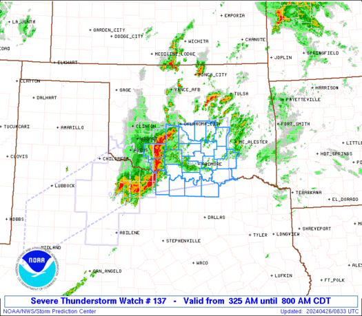
WW 137 SEVERE TSTM GA NC SC TN 102100Z – 110400Z 
 URGENT - IMMEDIATE BROADCAST REQUESTED
Severe Thunderstorm Watch Number 137
NWS Storm Prediction Center Norman OK
500 PM EDT Thu Apr 10 2025 The NWS Storm Prediction Center has issued a * Severe Thunderstorm Watch for portions of Northern and Central Georgia Far Southwest North Carolina Extreme Western South Carolina Eastern Tennessee * Effective this Thursday afternoon from 500 PM until Midnight EDT. * Primary threats include... Scattered large hail and isolated very large hail events to 2 inches in diameter possible Scattered damaging wind gusts to 70 mph possible SUMMARY...Scattered supercells should continue to pose some threat
for severe hail up to 1-1.75 inches in diameter through the rest of
the afternoon and into the evening. Damaging winds may also occur
with any clusters that can form, before convection eventually
weakens with eastward extent. The severe thunderstorm watch area is approximately along and 55
statute miles east and west of a line from 45 miles north northwest
of Knoxville TN to 30 miles south southeast of Atlanta GA. For a
complete depiction of the watch see the associated watch outline
update (WOUS64 KWNS WOU7). PRECAUTIONARY/PREPAREDNESS ACTIONS... REMEMBER...A Severe Thunderstorm Watch means conditions are
favorable for severe thunderstorms in and close to the watch area.
Persons in these areas should be on the lookout for threatening
weather conditions and listen for later statements and possible
warnings. Severe thunderstorms can and occasionally do produce
tornadoes. && OTHER WATCH INFORMATION...CONTINUE...WW 135...WW 136... AVIATION...A few severe thunderstorms with hail surface and aloft to
2 inches. Extreme turbulence and surface wind gusts to 60 knots. A
few cumulonimbi with maximum tops to 500. Mean storm motion vector
31035. ...Gleason
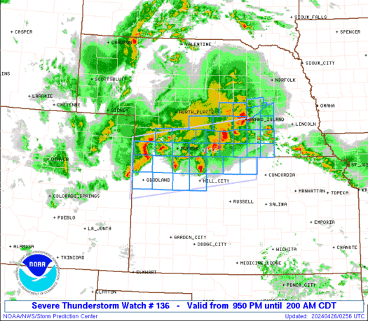
WW 136 SEVERE TSTM AL AR MS TN 102035Z – 110400Z 
 URGENT - IMMEDIATE BROADCAST REQUESTED
Severe Thunderstorm Watch Number 136
NWS Storm Prediction Center Norman OK
335 PM CDT Thu Apr 10 2025 The NWS Storm Prediction Center has issued a * Severe Thunderstorm Watch for portions of Northern and Central Alabama Far Eastern Arkansas Northern and Central Mississippi Far Southern Middle Tennessee * Effective this Thursday afternoon and evening from 335 PM until 1100 PM CDT. * Primary threats include... Scattered damaging winds likely with isolated significant gusts to 75 mph possible Scattered large hail likely with isolated very large hail events to 2 inches in diameter possible SUMMARY...Robust thunderstorms will continue to develop this
afternoon and spread southeastward through the evening. Supercells
will pose a threat for large hail generally ranging from 1-2 inches
in diameter. Scattered severe/damaging winds, with peak gusts up to
65-75 mph, should also occur as clusters form later this afternoon
and evening. The severe thunderstorm watch area is approximately along and 70
statute miles north and south of a line from 55 miles north
northwest of Greenwood MS to 25 miles northeast of Anniston AL. For
a complete depiction of the watch see the associated watch outline
update (WOUS64 KWNS WOU6). PRECAUTIONARY/PREPAREDNESS ACTIONS... REMEMBER...A Severe Thunderstorm Watch means conditions are
favorable for severe thunderstorms in and close to the watch area.
Persons in these areas should be on the lookout for threatening
weather conditions and listen for later statements and possible
warnings. Severe thunderstorms can and occasionally do produce
tornadoes. && OTHER WATCH INFORMATION...CONTINUE...WW 135... AVIATION...A few severe thunderstorms with hail surface and aloft to
2 inches. Extreme turbulence and surface wind gusts to 65 knots. A
few cumulonimbi with maximum tops to 500. Mean storm motion vector
31035. ...Gleason
Multiple agencies are responding to a helicopter crash in the cold waters of the Hudson River in New York on Thursday afternoon.
Officials in Beijing delayed the first ever humanoid robot half marathon where humans and human-looking robots were set to compete because of concerns the wind gusts could topple the bots.