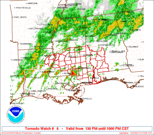
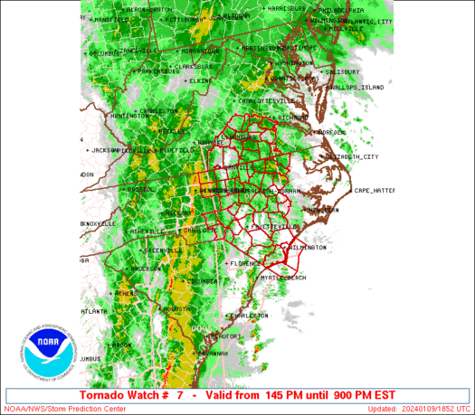
WW 7 TORNADO AL MS 130245Z – 130900Z
 URGENT - IMMEDIATE BROADCAST REQUESTED
Tornado Watch Number 7
NWS Storm Prediction Center Norman OK
845 PM CST Wed Feb 12 2025 The NWS Storm Prediction Center has issued a * Tornado Watch for portions of Southern Alabama Southeast Mississippi * Effective this Wednesday night and Thursday morning from 845 PM until 300 AM CST. * Primary threats include... A few tornadoes and a couple intense tornadoes likely Scattered damaging wind gusts to 70 mph likely SUMMARY...Scattered thunderstorms will affect the watch area through
the overnight area, in a region of very strong low-level winds. A
few of the storms may occasionally pose a risk of tornadoes and
damaging wind gusts. The tornado watch area is approximately along and 45 statute miles
north and south of a line from 125 miles west of Evergreen AL to 35
miles south southeast of Auburn AL. For a complete depiction of the
watch see the associated watch outline update (WOUS64 KWNS WOU7). PRECAUTIONARY/PREPAREDNESS ACTIONS... REMEMBER...A Tornado Watch means conditions are favorable for
tornadoes and severe thunderstorms in and close to the watch
area. Persons in these areas should be on the lookout for
threatening weather conditions and listen for later statements
and possible warnings. && OTHER WATCH INFORMATION...CONTINUE...WW 6... AVIATION...Tornadoes and a few severe thunderstorms with hail
surface and aloft to 1 inch. Extreme turbulence and surface wind
gusts to 60 knots. A few cumulonimbi with maximum tops to 500. Mean
storm motion vector 25035. ...Hart
Read more