SPC Severe Thunderstorm Watch 305 Status Reports

WW 0305 Status Updates
WW 0305 Status Image

 STATUS REPORT ON WW 305 THE SEVERE WEATHER THREAT CONTINUES ACROSS THE ENTIRE WATCH AREA. ..LYONS..05/24/24 ATTN...WFO...LZK...MEG...JAN... STATUS REPORT FOR WS 305 SEVERE WEATHER THREAT CONTINUES FOR THE FOLLOWING AREAS ARC001-041-069-079-085-095-107-117-250040- AR . ARKANSAS COUNTIES INCLUDED ARE ARKANSAS DESHA JEFFERSON LINCOLN LONOKE MONROE PHILLIPS PRAIRIE MSC011-013-015-019-027-043-071-083-097-107-119-133-135-155-161-
250040- MS . MISSISSIPPI COUNTIES INCLUDED ARE BOLIVAR CALHOUN CARROLL CHOCTAW COAHOMA GRENADA LAFAYETTE LEFLORE MONTGOMERY PANOLA QUITMAN SUNFLOWER TALLAHATCHIE WEBSTER YALOBUSHA THE WATCH STATUS MESSAGE IS FOR GUIDANCE PURPOSES ONLY. PLEASE
REFER TO WATCH COUNTY NOTIFICATION STATEMENTS FOR OFFICIAL
INFORMATION ON COUNTIES...INDEPENDENT CITIES AND MARINE ZONES

Read more

SPC Severe Thunderstorm Watch 305

WW 305 SEVERE TSTM AR MS 242320Z – 250400Z
WW 0305 Image

 URGENT - IMMEDIATE BROADCAST REQUESTED
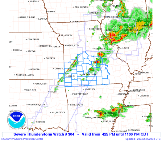
Severe Thunderstorm Watch Number 305
NWS Storm Prediction Center Norman OK
620 PM CDT Fri May 24 2024 The NWS Storm Prediction Center has issued a * Severe Thunderstorm Watch for portions of Southeast Arkansas Northwest Mississippi * Effective this Friday evening from 620 PM until 1100 PM CDT. * Primary threats include... Scattered large hail and isolated very large hail events to 2 inches in diameter possible Isolated damaging wind gusts to 70 mph possible SUMMARY...Scattered storms, some with supercell structure, may
persist for a few more hours while moving southeastward across
southeast Arkansas and northwest Mississippi. Occasional large hail
of 1-2 inches in diameter and damaging gusts of 60-70 mph will be
the main threats through late evening. The severe thunderstorm watch area is approximately along and 40
statute miles north and south of a line from 20 miles northwest of
Pine Bluff AR to 40 miles south southeast of Oxford MS. For a
complete depiction of the watch see the associated watch outline
update (WOUS64 KWNS WOU5). PRECAUTIONARY/PREPAREDNESS ACTIONS... REMEMBER...A Severe Thunderstorm Watch means conditions are
favorable for severe thunderstorms in and close to the watch area.
Persons in these areas should be on the lookout for threatening
weather conditions and listen for later statements and possible
warnings. Severe thunderstorms can and occasionally do produce
tornadoes. && OTHER WATCH INFORMATION...CONTINUE...WW 302...WW 303...WW 304... AVIATION...A few severe thunderstorms with hail surface and aloft to
2 inches. Extreme turbulence and surface wind gusts to 60 knots. A
few cumulonimbi with maximum tops to 550. Mean storm motion vector
31020. ...Thompson 

Read more

🔴 May 24, 2024 LIVE Texas Severe Weather & Tornado Coverage

🔴 May 24, 2024 LIVE Texas Severe Weather & Tornado Coverage

Live coverage and updates on severe thunderstorms impacting portions of Texas from the @texasstormchasers team… 🔴 Texas Weather Center LIVE Join this channel to get access to perks: https://www.youtube.com/channel/UCoIfgmxArIATc2EpHD3W9EA/join Check out our current LIVE STREAM: https://texasweather.video/ Our FREE WEATHER APP: https://texasweather.app/ Our WEBSITE/RADAR: https://www.texasstormchasers.com Our SOCIAL PLATFORMS: https://linktr.ee/texasstormchasers Donations – Paypal@texasstormchasers.com *Enable 4K 60FPS when […]

SPC Severe Thunderstorm Watch 304

WW 304 SEVERE TSTM KS MO 242125Z – 250400Z
WW 0304 Image

 URGENT - IMMEDIATE BROADCAST REQUESTED
Severe Thunderstorm Watch Number 304
NWS Storm Prediction Center Norman OK
425 PM CDT Fri May 24 2024 The NWS Storm Prediction Center has issued a * Severe Thunderstorm Watch for portions of Extreme southeast Kansas Southwest and south central Missouri * Effective this Friday afternoon and evening from 425 PM until 1100 PM CDT. * Primary threats include... Scattered large hail and isolated very large hail events to 2.5 inches in diameter likely Scattered damaging wind gusts to 70 mph possible SUMMARY...Thunderstorms are forming along a cold front and in the
open warm sector across southwest and south central Missouri. The
storm environment favors a mix of supercells and storm clusters
capable of producing isolated very large hail to 2.5 inches in
diameter and outflow gusts of 60-70 mph. The severe thunderstorm watch area is approximately along and 70
statute miles east and west of a line from 35 miles north of Vichy
MO to 30 miles south southwest of Monett MO. For a complete
depiction of the watch see the associated watch outline update
(WOUS64 KWNS WOU4). PRECAUTIONARY/PREPAREDNESS ACTIONS... REMEMBER...A Severe Thunderstorm Watch means conditions are
favorable for severe thunderstorms in and close to the watch area.
Persons in these areas should be on the lookout for threatening
weather conditions and listen for later statements and possible
warnings. Severe thunderstorms can and occasionally do produce
tornadoes. && OTHER WATCH INFORMATION...CONTINUE...WW 302...WW 303... AVIATION...A few severe thunderstorms with hail surface and aloft to
2.5 inches. Extreme turbulence and surface wind gusts to 60 knots. A
few cumulonimbi with maximum tops to 550. Mean storm motion vector
29025. ...Thompson 

Read more

SPC Severe Thunderstorm Watch 303

WW 303 SEVERE TSTM AR OK TX 242010Z – 250300Z
WW 0303 Image

 URGENT - IMMEDIATE BROADCAST REQUESTED
Severe Thunderstorm Watch Number 303
NWS Storm Prediction Center Norman OK
310 PM CDT Fri May 24 2024 The NWS Storm Prediction Center has issued a * Severe Thunderstorm Watch for portions of Western Arkansas Eastern Oklahoma North and Central Texas * Effective this Friday afternoon and evening from 310 PM until 1000 PM CDT. * Primary threats include... Scattered large hail likely with isolated very large hail events to 4 inches in diameter possible Scattered damaging winds and isolated significant gusts to 75 mph possible A tornado or two possible SUMMARY...Isolated to scattered severe storms are expected to
develop across the region through late afternoon and early evening,
including supercells capable of very large hail. A few storm
clusters with an increased damaging wind risk may evolve by early
evening within a very unstable environment. The severe thunderstorm watch area is approximately along and 80
statute miles east and west of a line from 40 miles north of
Fayetteville AR to 50 miles southwest of Temple TX. For a complete
depiction of the watch see the associated watch outline update
(WOUS64 KWNS WOU3). PRECAUTIONARY/PREPAREDNESS ACTIONS... REMEMBER...A Severe Thunderstorm Watch means conditions are
favorable for severe thunderstorms in and close to the watch area.
Persons in these areas should be on the lookout for threatening
weather conditions and listen for later statements and possible
warnings. Severe thunderstorms can and occasionally do produce
tornadoes. && OTHER WATCH INFORMATION...CONTINUE...WW 302... AVIATION...A few severe thunderstorms with hail surface and aloft to
4 inches. Extreme turbulence and surface wind gusts to 65 knots. A
few cumulonimbi with maximum tops to 500. Mean storm motion vector
26025. ...Guyer 

Read more