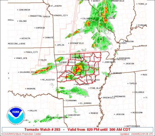
WW 283 TORNADO AR 220120Z – 220800Z
URGENT - IMMEDIATE BROADCAST REQUESTED
Tornado Watch Number 283
NWS Storm Prediction Center Norman OK
820 PM CDT Tue May 21 2024 The NWS Storm Prediction Center has issued a * Tornado Watch for portions of North cental and central Arkansas * Effective this Tuesday night and Wednesday morning from 820 PM until 300 AM CDT. * Primary threats include... A couple tornadoes possible Scattered large hail and isolated very large hail events to 2 inches in diameter possible Scattered damaging wind gusts to 70 mph possible SUMMARY...A few supercells will be possible through the early
morning hours, in an environment favorable for large hail of 1-2
inches in diameter, damaging gusts of 60-70 mph, and a couple of
tornadoes. The tornado watch area is approximately along and 70 statute miles
east and west of a line from 35 miles northeast of Flippin AR to 40
miles south southeast of Russellville AR. For a complete depiction
of the watch see the associated watch outline update (WOUS64 KWNS
WOU3). PRECAUTIONARY/PREPAREDNESS ACTIONS... REMEMBER...A Tornado Watch means conditions are favorable for
tornadoes and severe thunderstorms in and close to the watch
area. Persons in these areas should be on the lookout for
threatening weather conditions and listen for later statements
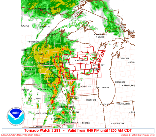
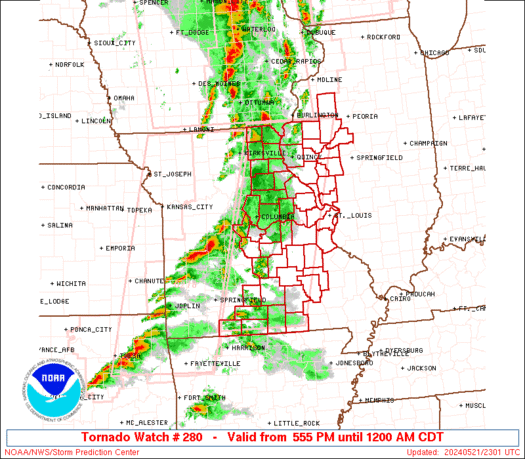
and possible warnings. && OTHER WATCH INFORMATION...CONTINUE...WW 277...WW 278...WW
279...WW 280...WW 281...WW 282... AVIATION...Tornadoes and a few severe thunderstorms with hail
surface and aloft to 2 inches. Extreme turbulence and surface wind
gusts to 60 knots. A few cumulonimbi with maximum tops to 550. Mean
storm motion vector 27025. ...Thompson
Read more